Slope Stability Radar
Cost-Effective, All-Weather Monitoring Network Solution
Capture sub-millimeter level
displacement changes with
Chainzone Slope Stability Radar
Leveraging advanced millimeter-wave radar technology, the system delivers long-range, high-precision surface deformation monitoring for slopes, dams, and other critical areas.
It operates autonomously 24/7 in all weather conditions, capturing sub-millimeter displacement changes in real time to provide accurate and timely early warnings for geohazards and infrastructure safety.
<0.1 mm
Deformation Accuracy
600 m
MAX. Monitoring Range
±45 °
Horizontal Field
of View
<15 W
Power
(Solar-Ready)
Moving Beyond Reactive Measures to Proactive Prevention.
Traditional monitoring methods leave highway authorities one step behind. The CR-S16 changes that.
TRADITIONAL METHODS
Contact-Based Monitoring
(GNSS, Crack Meters)
- High Cost: Invasive installation, drilling, and complex surveys.
- Sparse Coverage: Point-based sensors create blind spots.
- Difficult Maintenance: Physical access required for repair.
- Reactive Response: Alerts often come too late.
CR-S16 RADAR SOLUTION
Non-Contact Surface
Deformation Monitoring
- Cost-Effective: No excavation. Single device covers entire slope.
- Wide-Area Coverage: ±45° FoV eliminates blind spots.
- Zero-Maintenance: Non-contact, solar-powered, remote.
- Proactive Warning: Detects sub-mm movements early.
Engineering Excellence
Designed for the Field.
0.1mm Accuracy Across a 90° Arc.
Powered by advanced MIMO radar architecture, the CR-S16 achieves sub-millimeter deformation accuracy across a wide ±45° horizontal field of view. A single unit covers the entire slope, eliminating blind spots inherent to point-based sensors.

Deploy in Hours. Powered by the Sun.
Compact form factor (256×198mm) and simple pole-mounting allow single-person installation in hours. With <15W power consumption and solar compatibility, it operates autonomously in remote locations without grid connection.

From Raw Data to Actionable Insight.
The intelligent platform transforms radar data into real-time deformation heat maps. Automated alert logic triggers multi-channel notifications to crews. Integrates with VMS for automated traffic control to prevent incidents.


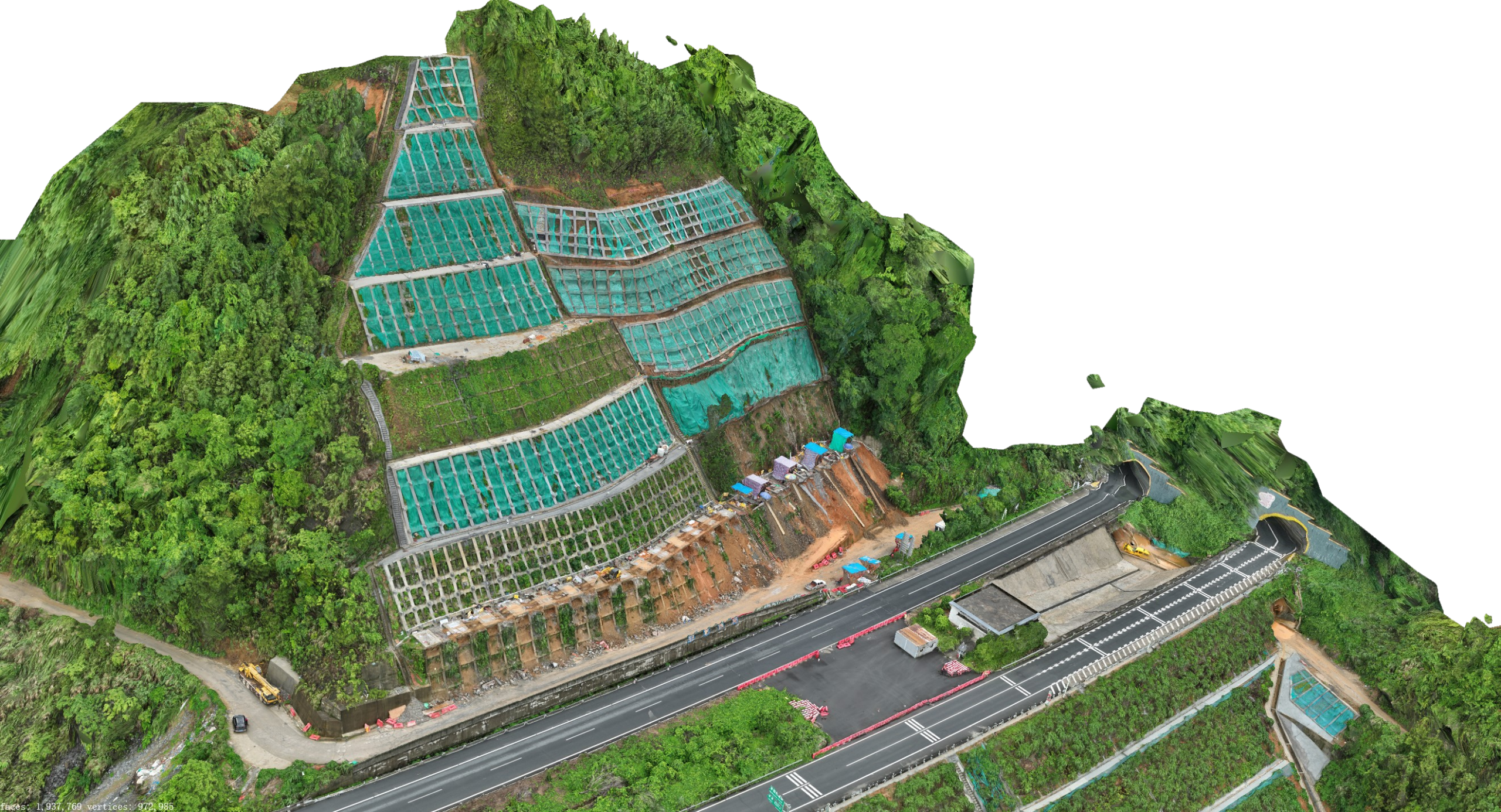
Protecting Critical Infrastructure on the G78 Expressway with CR-S16
Real-world validation against GNSS benchmarks on a reinforced highway slope in Lianzhou, China.
FIELD-PROVEN
Location
G78 Expressway, Reinforced Slope
Set Up
CR-S16 + Solar + 4G
Range
From 50m to 140m
Benchmark
Validated vs. GNSS
±3 mm
Outperformed GNSS
Readings within ±3mm, exceeding existing benchmark accuracy.
Stable Signal
Highly Stable Signal
Reflector echo power variance held within ±2dB.
All-Weather
Rain-Proof
Minimal impact during rain events (Jan 21, 26, 27).